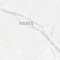
Precise GPS coordinate tool | WGS84, DMS, Web Mercator


| GPS WGS84: | 48.8566000°, 2.3522000° |
| GPS DMS: | 48° 51' 23.8" N, 2° 21' 7.9" E |
| Web Mercator: | X: 261845.71 m | Y: 6250564.35 m |
Forward Geocoding (Address to GPS): Type any global address, click "Search & Locate" — we fetch precise GPS coordinates (latitude/longitude) via Nominatim API, drop a marker, and display full address details in English.
Reverse Geocoding (GPS to Address): Click anywhere on the map OR use any coordinate input / "My Location" — the system automatically queries Nominatim to get the street address, city, country from GPS coordinates.
GPS Coordinate Systems: WGS84 decimal degrees, DMS (Degrees/Minutes/Seconds), Web Mercator (meters) with one-click copy. Ideal for GIS, fieldwork, asset tracking, and GPS navigation.
✅ Powered by OpenStreetMap & Nominatim. Respects usage policy — User-Agent set. All GPS results in English.
Welcome to the most straightforward GPS tool for instant coordinate conversion, address geocoding, and reverse geocoding. Whether you are a developer, surveyor, traveler, or GIS enthusiast, this tool helps you transform between latitude/longitude and physical addresses with high accuracy.
The tool supports multiple coordinate formats including decimal degrees (DD), degrees decimal minutes (DDM), and degrees minutes seconds (DMS). You can also search for any location by address and get precise GPS coordinates powered by high‑resolution maps.
All conversions are performed in real‑time using reliable geocoding APIs. The tool respects your privacy: no input data is stored permanently on our servers.
Geocoding transforms a textual address (e.g., "1600 Amphitheatre Parkway, Mountain View, CA") into geographic coordinates (latitude, longitude). Reverse geocoding does the opposite – it takes latitude/longitude numbers and returns the nearest street address or place name.
Our GPS tool supports WGS‑84, the standard used by GPS devices and most mapping platforms like Google Maps, Bing Maps, and OpenStreetMap. We also display coordinates in decimal degrees (e.g., 40.7128, -74.0060) and degrees/minutes/seconds (e.g., 40°42'46.1"N 74°00'21.6"W).
Yes, the basic geocoding and coordinate conversion features are completely free for both personal and commercial projects. We may introduce rate limits for extremely high‑volume usage to ensure fair access for everyone.
While Google Maps is great for navigation, our tool focuses on precise coordinate manipulation, batch processing, and multiple output formats. It is lightweight, privacy‑friendly, and designed specifically for developers and GIS workflows.
From autonomous vehicle navigation to drone flight planning and property surveying, reliable coordinate conversion is essential. Even a small rounding error can shift a location by several meters. Our tool uses double‑precision arithmetic and direct API connections to authoritative mapping sources to maintain sub‑meter accuracy where available.
The interactive map is rendered using professional mapping libraries, ensuring smooth zooming and panning. Every click or search gives you instant feedback without page reloads.